
 Temuco - Photos: Jorge González
 Located in the IX Chilean Region, widely known as La Araucanía, the City of Temuco was the last bastion of the Mapuche people upon the arrival of the white man.
In the Mapuche tongue, temuco stands for temu water. The temu is a native tree in these latitudes which may be observed all throughout the region along with the monkey-puzzle tree, another favorite among visitors.
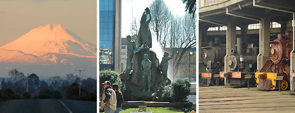
The city is one of the biggest in the area and it is visited year round by local tourists and travelers coming from neighboring countries. The main sights include the Pablo Neruda Railway National Museum and the Araucanía Regional Museum, whose doors open up to show all the natural and historical secrets of this territory.
But a stop at the Municipal Market is a must while in Temuco. Its smells, colors and especially the diversity of dishes served there are a faithful reflection of the local culture.
Outside the city, its National Parks, its volcano and its mountains are also ideal scenes for outdoor recreational activities.
History and nature, the City of Temuco has everything for visitors. They just need to come along.